aera® 760
ADVANCED PORTABLE AVIATION NAVIGATION WITH A 7” DISPLAY
Bright days are no problem — with our vivid, sunlight-readable touchscreen display.
![]()
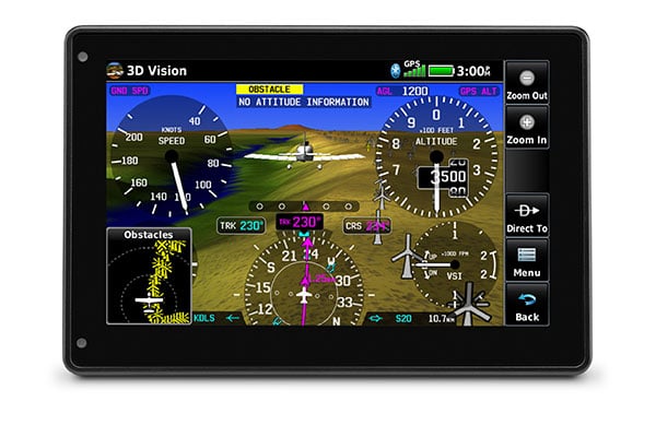
Be aware down low. See obstructions and wires with our WireAware™ wire-strike avoidance technology.
![]()
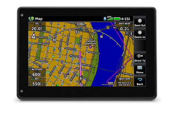
Prep for your flight with wireless Internet weather and automatic data downloads.
![]()
Your handheld reference, wherever you fly.
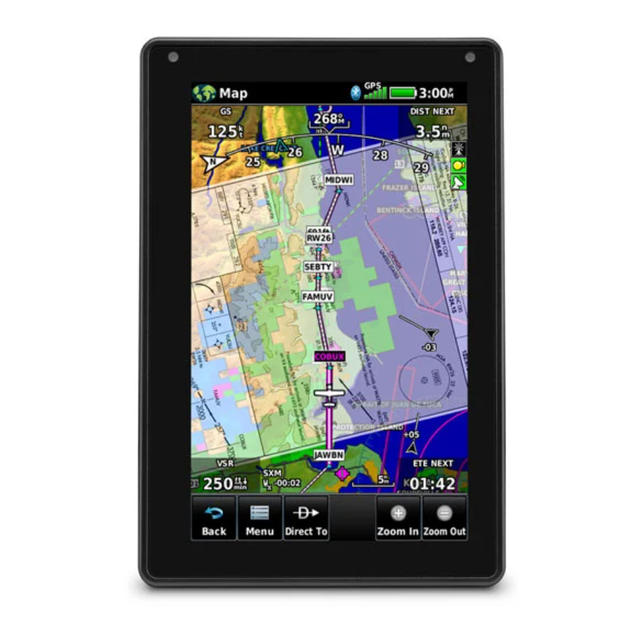
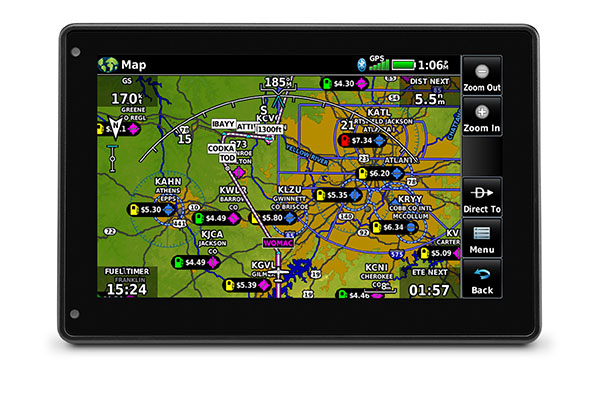
DYNAMIC MAPS
Quickly and reliably acquire GPS and GLONASS satellite constellations to display rich, interactive, dynamically drawn and customizable aviation maps.
Advanced navigation. In a portable package.
MAP TOPOGRAPHY
View ground references — including airports, cities, terrain, obstacles and more — on the dynamic map display to easily determine your position on VFR flights.
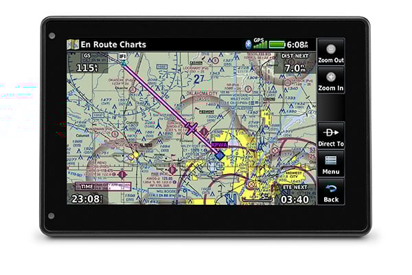
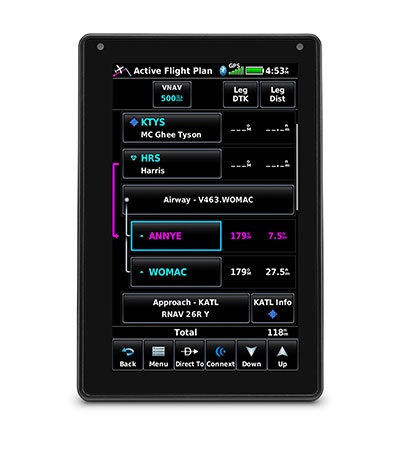
IFR ENROUTE CHARTS
Use IFR map mode to display and navigate on high or low enroute airways. Touch to view Minimum Enroute Altitudes and distances between intersections.

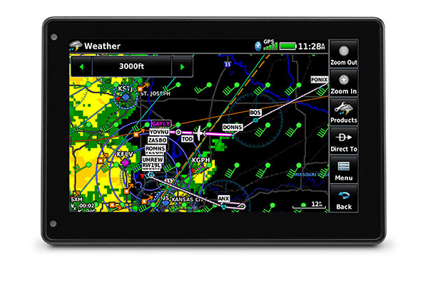
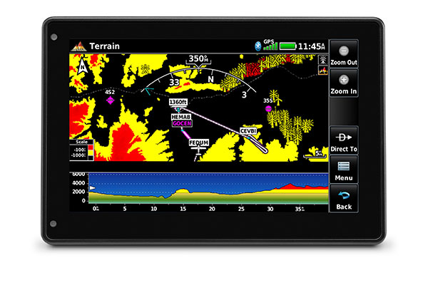
ADS-B DATALINKS
With available Garmin ADS-B “In” equipage solutions, aera 760 displays ADS-B traffic targets as well as subscription-free U.S. weather data — either wirelessly or with an optional power/data cable.
![]()
TERMINALTRAFFIC™ DISPLAY
Providing a dynamic display of ADS-B-equipped aircraft and ground vehicles, this technology helps pilots avoid traffic conflicts within the airport environment.
Improved awareness. For better decision making.
SMART AIRSPACE™
Patented Garmin Smart Airspace guidance highlights the airspace nearest your current altitude so you can quickly identify your location relative to the airspace around you.
SYNTHETIC VISION
View Synthetic Vision (SVX™) by panel-mounting your aera 760 and using its built-in AHRS, or by connecting it to another device with an AHRS, such as a GDL 52 series datalink.
WIREAWARE™
Garmin WireAware wire-strike avoidance technology graphically overlays Hazardous Obstacle Transmission (HOT) lines that span rivers and canyons right on the moving map.
Updated information. That’s ready to go.
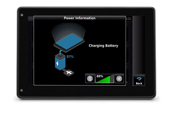
WI-FI® UPDATES
View Internet weather on the ground for pre-flight planning, and update databases at home via Wi-Fi. Plus, stay current throughout the year with a single annual subscription that includes all the databases you need.
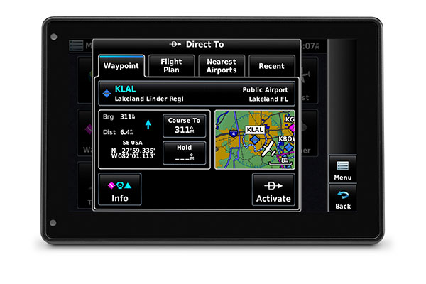
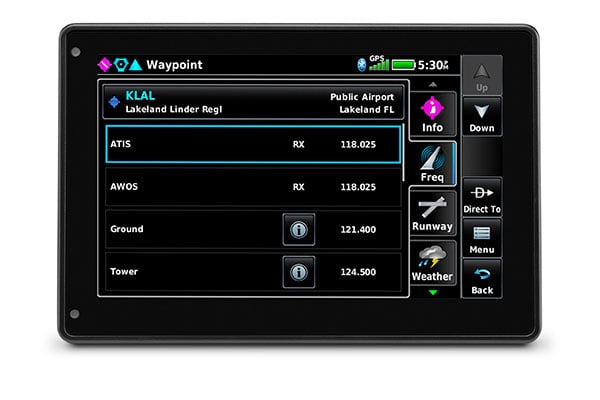
AIRPORT INFORMATION
Touch an airport symbol on the map to view its airport information page, and see runways, frequencies, NOTAMs, FBOs and more.
DEDICATED PARTNER
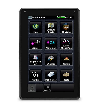
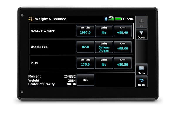
aera 760 combines many of the capabilities of panel-mounted avionics with a value-packed, purpose-built package. It’s ready to fly, right out of the box.
Physical & Performance
- Physical dimensions: 7.29”W x 4.85”H x 0.91”D (18.5 x 12.3x 2.3 cm)
- Display size: 7" diag (17.8 cm)
- Display resolution, WxH: 480 x 800; portrait and landscape orientation
- Display type: touchscreen WVGA color TFT with white backlight
- Weight: 19.8 oz (561 g)
- Battery: Rechargeable lithium-ion
- Battery life: Up to 4 hours during most daytime conditions, (80% backlight)
- SBAS/WAAS/GLONASS receiver: high-sensitivity with WAAS position accuracy
- Voltage range: 10-35
- Route Data: VFR/IFR
- USB connection: yes (USB-C)
- Expandable memory: yes (microSD™ cards)
This device is not approved for primary IFR navigation.
- aera 760
- Mount cradle with CLA power cable
- USB-C 27W AC adapter
- USB-C to USB-C cable
- USB-C to USB-A cable
- Quick start manual and related documentation